Saturday, December 13, 2014

Burmese Days 6: Sule Pagoda and Rangoon Heritage Tour

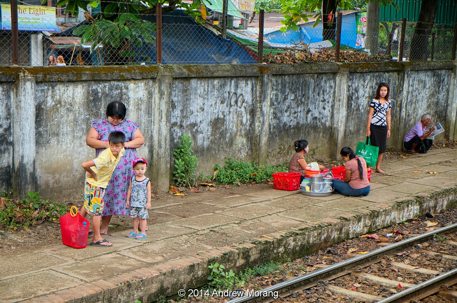
Rangoon, now officially known as Yangon, is the largest city in Burma and was the capital until the military government relocated the capital to the newly-built city of Naypyidaw in 2006. Rangoon is still the commercial and cultural center of the country and has a population of more than 5 million (some estimates are 7 million).

The British came to Burma in the early 1800s and captured the city, then known as Yangon, during the First Anglo-Burmese War (1824–26). Much of the city was destroyed by fire in 1841. After the Second Anglo-Burmese War of 1852, the British seized Yangon and began to transform it into the commercial and political hub the colony. Based on a design by an army engineer, they rebuilt the city on a modern grid pattern, with east-west and north-south streets centered on the historic Sule Pagoda. According to Wikipedia (citing various sources), "Colonial Yangon, with its spacious parks and lakes and mix of modern buildings and traditional wooden architecture, was known as "the garden city of the East." By the early 20th century, Yangon had public services and infrastructure on par with London."

The photograph above shows the Sule Pagoda in 1957, when the streets were tree-lined and had little traffic. Back then, only diplomats and Americans had cars. This is a scan from a Kodachrome slide taken with a Leica IIIC camera. The view is looking south along Sule Pagoda Road, with City Hall on the left.
The map (from University of Texas Libraries) shows Rangoon in 1914 (click the map to enlarge it, as with all the photographs). The Shwedagon Pagoda is on the hill in the northern suburbs, while the newly laid-out city grid has the Sule Pagoda as its center origin. The thick black lines are railroads.
This is an aerial photograph from the family archives. The Shwedagon is in the center left, while the Sule Pagoda is near the bottom. The large building to its right is the huge City Hall. In 1957, Rangoon was a flat city with buildings no more then 3 or 4 floors high. I do not know why none were higher. I wonder if the lack of fire-fighting ability or undependable electric supply (meaning undependable elevators and air-conditioning) might have been reasons?
This is the Sule Pagoda today, with more traffic and some modern tall buildings in the background. The City Hall is to the right. This photograph was from the second floor of the historic Emmanuel Baptist Church. According to legend, part of the Sule may be 2,500 years old, but most of what we see is less than a century old.
This is a 1957 photograph of the City Hall. It was built between 1926 and 1936 and was designed by Burmese architect U Tin, who was also responsible for the huge Central Railway Station. The tiered roofs are called Pyatthat, common in many Buddhist structures. The size of the City Hall and the amount it must have cost gives an idea of the importance of Rangoon to the British Empire. They assumed the empire would last and wanted to be prepared with appropriate administrative and structural infrastructure. But war was to follow in a few years, and the British fled Rangoon in early 1942 under the onslaught of the Japanese Imperial Army. The British returned in 1945, only to grant independence to Burma in 1948.
South of the Sule Pagoda is a 1931-vintage British building, still in use but pretty rough.
This is the interior of the handsome Emmanuel Baptist Church. The original church was built in 1885 by American Missionaries but destroyed in World War II. The present building is from 1952.
35th Street runs behind the Emmanuel Church. It was dead end and looked crowded, so I could not resist. The old British building had seen better days.
Closer-up, the building is really rough, and there is a lot of trash strewn about. It's a real pity. The red brick wall to the right is part of the High Court Building.
Proceed a couple of blocks, and there is a brass sign indicating the telegram office. Is it possible?
There IS a telegram office, and even an employee or two present. I do not know if you can send a cable to the USA any more (I should have tried). Who would deliver a telegram to your house? A small sign at the end said, "Internet."
A couple of blocks north on Bo Gyoke Road are many more old British flats. This one also needs a bit of work.
This is the former Myanmar Railways Headquarters. The land has been bought by a developer who will build towers but restore the old brick building.

Rangoon is becoming an architecture destination. Numerous journalists have recognized Rangoon's amazing colonial architecture, and a Google search will bring up plenty of references. As an example, The Independent wrote how the "Colonial past could be the saving of Rangoon."

Thant Myint-U (2011) in a Financial Times article, wrote, "It’s one of the best preserved colonial cityscapes in the world. Rangoon’s unique architectural heritage has survived decades of war, dictatorship, isolation and economic decline. Whether it survives a transition to democracy and renewed prosperity remains to be seen."

To be be continued....

References

Thant Myint-U, 2011. Forgotten treasures, Financial Times, Dec. 2, 2011.

Wednesday, December 10, 2014

Burmese Days 5: Historic British Houses in Rangoon

Rangoon must have once been an amazingly wealthy city, as evidenced by some of the remaining mansions of industrialists and government officials.  At 291 Shwedagon Pagoda Road, there are a couple of old mansions semi-hidden behind walls. My taxi driver was perplexed that I was interested in old houses, but he knew exactly where to take me for some good examples.
This amazing old mansion was once quite a showplace. Look at the Victorian trim (still existent, thanks to the durability of teak), gables, and overhanging soffits. It was designed to cope with a climate that dumped major rain during the summer monsoon and exposed its occupants to stifling heat.
Carriages or Rolls Royces once brought visitors through the breezeway.
The interior must have once been gorgeous. Look at how the same Corinthian column motif from the breezeway was repeated next to the stairwell.
Next door is another old mansion, this one with wide awnings and almost an alpine look. Assuming it was empty, I was about to barge inside and wander around when I saw some recent-vintage cars in the side driveway. Oops, it is occupied. Discretion took over and I headed back to the abandoned house next door.
From the van, we were stopped in traffic for a few minutes right outside another mansion at 105 Kabaaye Pagoda Road. Notice that the gatehouse was modern construction with a rather wild checked pattern.
Recent apartments are rather uninspired architecture and are typically poorly-maintained. The mildew eventually creeps over every surface, and, from what I could tell, the building owners seldom pressure-wash or bleach. The bottles in the lower right are for drinking water.

For another historic Rangoon house, please see my earlier article on the Lin Chin Tsong Mansion.

Photographs taken with a Panasonic G3 camera with Olympus 9-18mm lens or a FujiFilm X-E1 camera. RAW files converted with PhotoNinja software.

Saturday, December 6, 2014

Burmese Days 4: the Rangoon Circle Train

The Rangoon Circle Train is a commuter line that takes a leisurely and bumpy route from the Rangoon Central Station to the northern suburbs and back in about three hours. The Circle is not on the normal tourist inventory but is popular with independent travelers because it is such an interesting cultural excursion.


To take the ride, go to the imposing Rangoon Central Station. Guards or station employees will direct you to the crossover to Tracks 3 and 4. The crossover also gives access to Pansodan Street, which crosses the rail yards on a highway bridge. At the ticket office on the platform, we bought the 600 kyat (tɕaʔ) (= $1.00!) ticket for the "luxury" air-conditioned train. At the last minute, we took the non-air-conditioned train with open windows instead, which should have cost only 100 kyats (15 cents).


Here is the ticket, neatly filled out by hand on multiple copies and officially stamped.


The rails and rolling stock look well-used. The locomotives were imported, but I saw a newspaper article that said locomotives would soon be built in Burma. Ask someone which train to take. Possibly it does not matter. Take some water with you, although vendors in stations sell bottled water. Do not drink too much because toilets might be a bit dicey.


The train trundles along at a leisurely 15 miles per hour, stopping every few minutes at one of the stations. The track is so rough, the stops are a good time to take photographs.


Some of the stations are left from the British era, while others are simple concrete platforms with steel rain covers and a ticket office.


This is one of the family photographs from the 1950s, showing a Hindu procession (possibly funeral) somewhere along the tracks. The wood English-looking building in the background may be a station. (This was an Anscochrome color slide taken with a Leica camera.)


What is so interesting about the Circle train is the window into the day-to-day lives of ordinary people. You see them eating, waiting, working, selling, talking, and tending to their children.


Odd sights await you: I think these people were drying sardines out in the sun. Yummy.


Best of all might be your fellow passengers. They must see enough tourists now such that we are not curiosities any more. The lady above had some sort of sweets, like doughnuts. She bought them somewhere and used the train to reach her selling area.


This gent also had some sort of sweets in his tubs. Notice his outfit. He is wearing a cotton longyi, used almost universally by gents and ladies in Burma, and flip flop shoes. On his head is a bamboo leaf pith helmet. In northern Burma, these bamboo hats are are often coated with crude oil to protect the fiber (and add some aromas?).


If you do not want to take the full 3+-hour circle, one option is to get off at Insein Station in the northern suburbs. Near the river in Insein is a British-era prison, infamously used by the military government for political prisoners. Insein is about a half-hour taxi ride to downtown Rangoon.


A steel bridge crosses the tracks, and several shops are clustered around the station. A fellow who crossed on the bridge helped us flag down a taxi and negotiate the price. That is an example of the Burmese people: friendly and gracious.

The Circle Train is great fun! Take it.

The Myanmar Times has an article on upgrading the Circle Line. The Irrawaddy describes the Japanese-built air-conditioned train (the one we did not try).

I took these photographs with a Fuji X-E1 digital camera and processed the RAW files with PhotoNinja.

Monday, December 1, 2014

Burmese Days 3: The Rangoon Central Railroad Station

This is the third article on our tour of Rangoon, which is full of amazing architecture. The Central Railroad Station, off Kun Chan Road, is one of the oddest stations you are likely to ever see. The original on this site was bombed by Japanese planes early in World War II, and the building was destroyed by the retreating British troops in 1942. The present building was built (or rebuilt) between 1947 and 1954 based on a design by an engineer Hla Thwin, who used traditional Burmese architectural styles. The four pagoda-like towers are unusual and striking. The grounds north of the station (to the left in the top photograph) once consisted of extensive lawns, but now they are a concrete parking lot.

The size of the Central Station gives you an idea of the importance of the rail network in the immediate post-colonial era. The builders must have assumed that Burma would again be one of Asia's economic powers, as it had been before World War II. Recall that following occupation and wartime destruction, Thailand, Malaysia, Indonesia, Cambodia, Vietnam, and Laos were impoverished and close to starvation (the Green Revolution had not yet greatly increased rice yields). According to Wikipedia, the Central Station is among 190 buildings on the Yangon City Development Committee’s list of heritage structures worthy of preservation.
Walk in the central entrance, and you enter an elegant ticket hall. This is where you buy long-distance train tickets. The ticket boots are from a previous era - no computers, no terminals, just some agents selling tickets. The signs are mechanical, meaning paper.
The next ticket hall to the east looks similar (and I am not sure why there were two halls), but this one has a modern feature: there is an ATM machine, a recent innovation in Burma (post-2013?). I tried to go upstairs, but all doors were locked. I do not know if offices in the upper floors are occupied.
The shed next to the tracks is quiet, but there are plenty of chairs awaiting their occupants.
If you plan to take the Circle train, you cross over to tracks 3 and 4. A guard directs you. An agent in the square ticket house way in the distance will write out a ticket for you and collect your 600 Kyats (= $1 US). From the overpass, you can also ascend to the Pansodan Street street overpass.
The locomotives, rolling stock, and tracks are a bit rough. Older locomotives were imported, but a newspaper article stated that the Burmese were beginning to make locomotives domestically.
From the Pansodan Street overpass, you can see that a large section of the rail yard is semi-deserted, the tracks slowly growing over with brush. It was likely much busier in the British era. The rusty water tower was probably for steam locomotives, and I read about a plan to introduce steam trains for tourists.
Another remnant of the British era is this handsome brick church across the street from the station. I think it is St. Anthony's Catholic Church, but may have written the wrong name. Once, Rangoon was a city of graceful church steeples, with every possible Protestant and Catholic denomination. It was a melting pot of religions, and you still see churches, mosques, temples, and synagogues only blocks from each other.

For previous articles, please click the links:
The deserted Pegu Club.
The odd Lim Chin Tsong mansion/palace.

These digital images are from my Panasonic G3 camera with 9-18mm Olympus lens or a Fuji X-E1 camera with Fuji 18-55mm lens. I processed the RAW files with Photo Ninja software. I also used Kodak Tri-X film in a Leica camera here, but have not yet scanned the negatives.