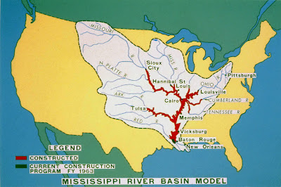
The Mississippi River Basin Model at the Waterways Experiment Station (WES) was the largest hydraulic model ever built. It was also the most complex attempt ever undertaken to model the river system that drains a good part of the North American continent. The purpose of the model was to test the behavior of the 1.25 million square mile
Mississippi River and Tributaries Project and evaluate levees, floodways, cutoffs, and reservoirs. The ambitious project was conceived by Lt. General Eugene Reybold in the early 1940s after smaller models had proven their worth in examining the behavior of individual projects.

During World War II, many engineers and technicians were serving in the war effort and manpower was scarce. General Reybold arranged to use German prisoners of war as laborers to clear and prepare the site. A site was chosen in Clinton, Mississippi, about 35 miles east of the Waterways Experiment Station in Vicksburg. By the end of the war, about 1,800 prisoners of the Afrika Korps were living nearby in an internment camp. I have read that many of these men were engineers and highly-trained professionals who worked on the project with enthusiasm and typical German precision and engineering prowess. (Also, this assignment may have been a bit more pleasant than cutting timber in lumber camps in Wisconsin in winter.). Some of the officers married Clinton women.
The project took 20 years to complete, with the last sections finished in 1966. WES used the model during the great flood of 1973 to predict what would happen if the Old River Control Structure in Louisiana were to fail, allowing a major portion of the of the Mississippi system's water to flow down the Atchafalaya watershed. The last use was in 1993, during the
record-breaking floods of the Mississippi system in the upper Midwest. When the Corps planned to breach some of the main stem levees near Prairie du Rocher and Fort de Chartres, Illinois, the model was partially revived to examine water flow and effects of the levee breaches. The Corps finally closed the project permanently and turned the land over to the City of Jackson in 1993. The City of Jackson mowed the grass through 2006, but abandoned all maintenance after that.

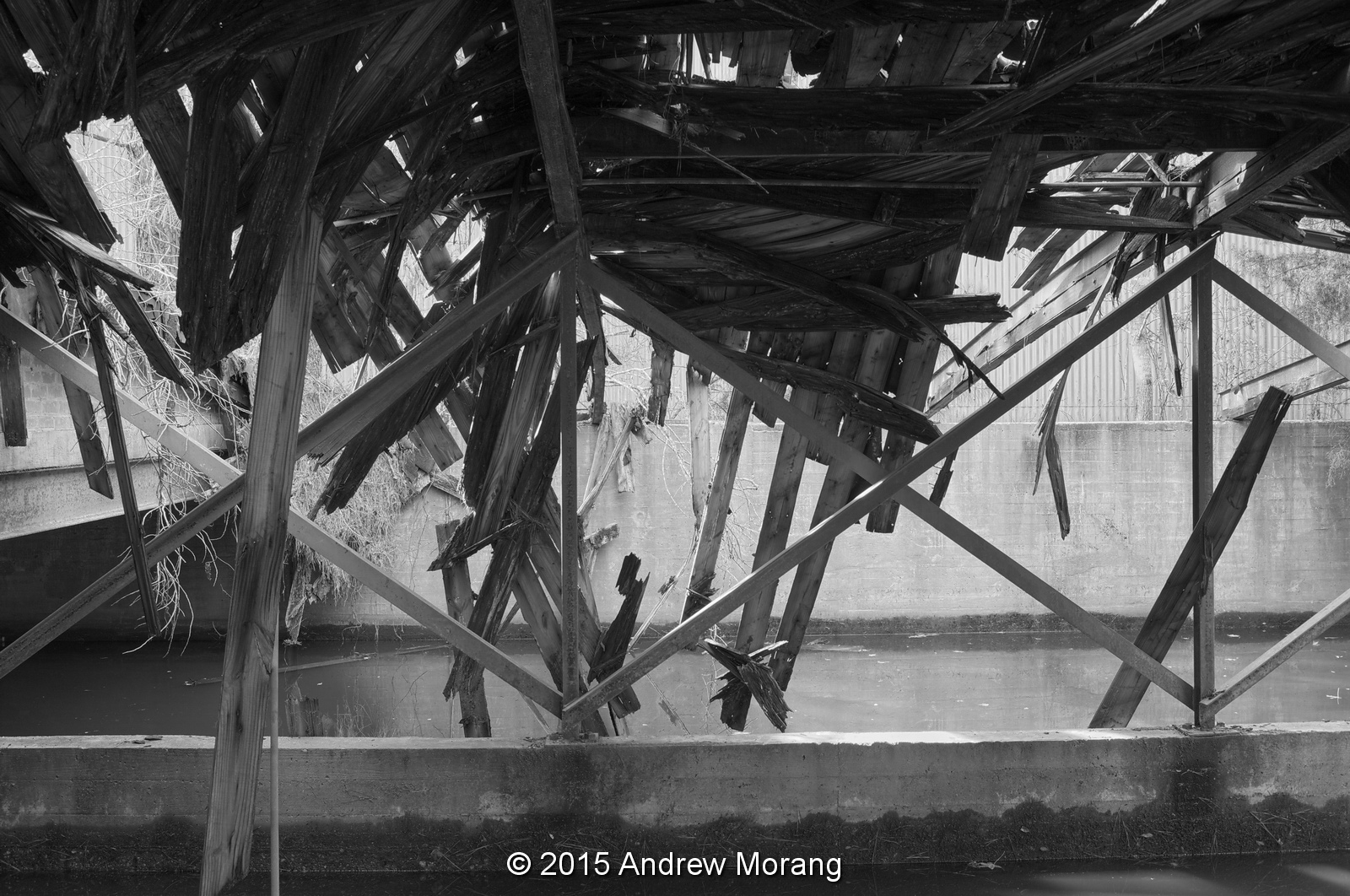
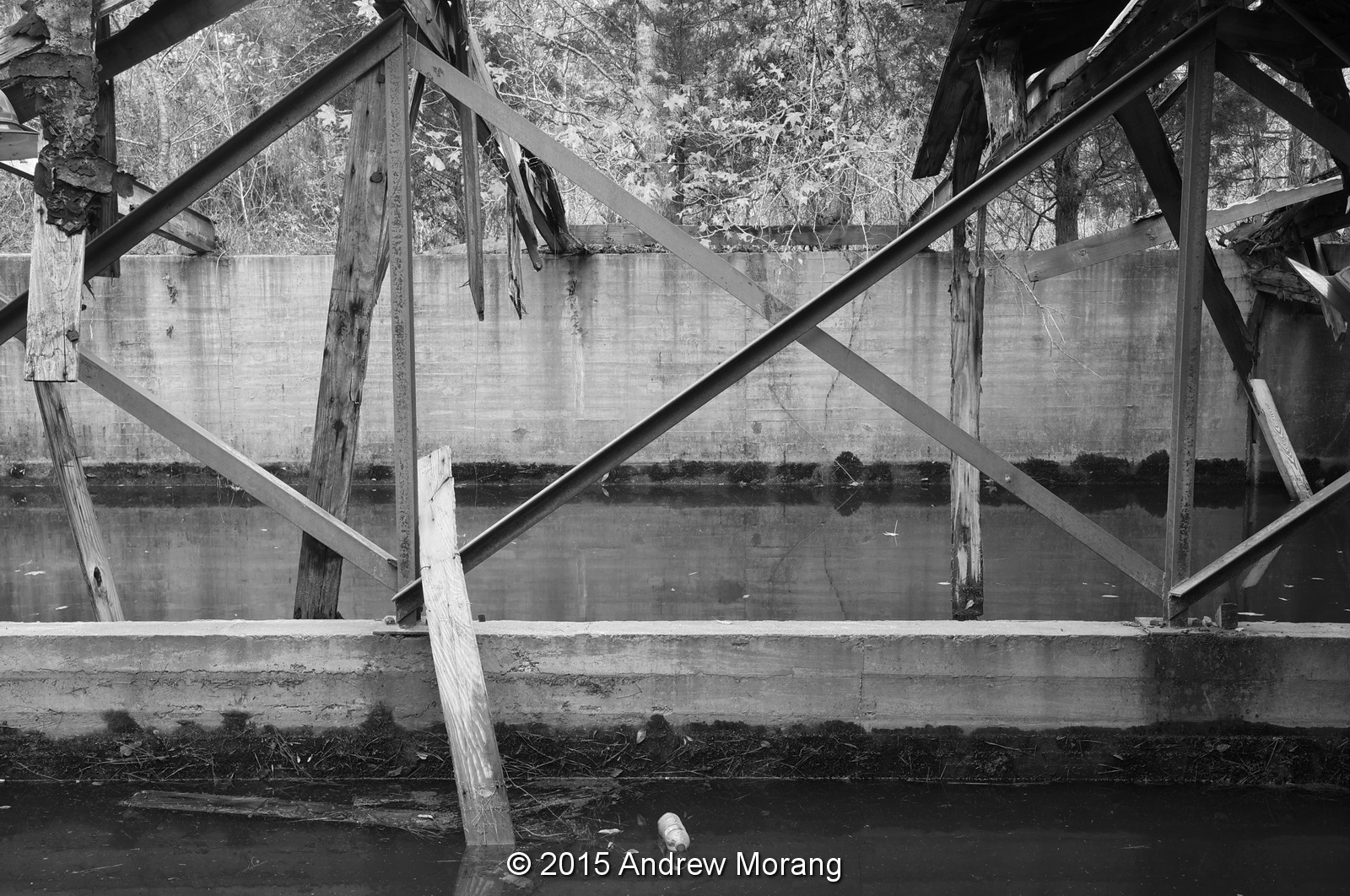
The concrete portions of the model are still largely intact. You can easily visit the site by taking Springridge Road south from Interstate 20 and then turning left on McRaven Road. Turn left into Buddy Butts Park. Part of the site has a fence, but much of it has fallen down. The land is no longer clear as in the aerial photograph above, and brush and trees are slowly taking over. But, as of January 2010, you can still easily climb the observation platforms, walk around in the river basins, and pretend that you have walked from Morgan City to Sioux City.
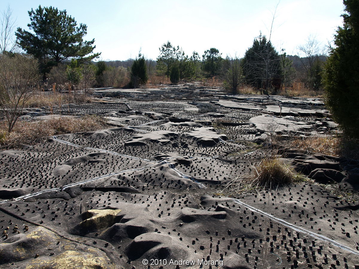
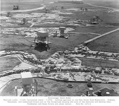
The concrete shaping of the landscape was amazing. Imagine the survey skill required to precisely shape the terrain representing a major portion of the continent. The little pegs in the channels are friction elements.
Some of the buildings are falling down, but several of the control houses are largely intact.
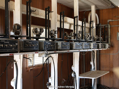 |
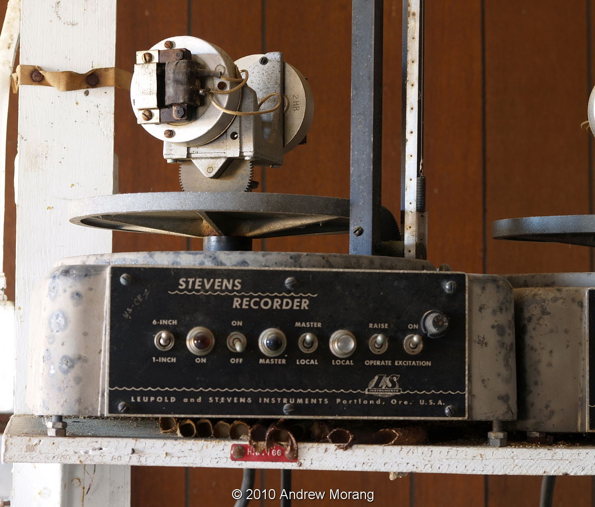
Stevens paper chart recorders
|
The control buildings still have rows of Stevens paper chart recorders on shelves, abandoned in place just as if the technicians planned to return to work some morning. One of my coworkers was a property officer and remembers how she had to record the serial numbers on all the instruments and pumps annually. (July 2016 update: the recorders have been stolen.)
The massive pumps are still in place, slowly rusting and getting overgrown. From what I can tell, the City of Jackson does not maintain anything on the site. This is a good example of how nature takes over, a small scale experiment of the transitions speculated in the History Channel's
Life After People.
I took these photographs on January 18, 2010 with an Olympus E-330 digital camera. The first three photographs in this blog are courtesy of the Coastal and Hydraulics Laboratory, Engineer Research and Development Center, U.S. Army Corps of Engineers, Vicksburg, Mississippi.
Update May 7, 2013 (anniversary of V.E. Day): The historian of Mississippi Valley Division, Mr. Charles Camillo, generously sent me this photograph of the POWs working on one of the drainage canals. Date and photographer not recorded.