At one time, Route 66 extended between Santa Fe and Albuquerque. As far as I can tell, today there are few 66 remains between the two cities. But my Santa Fe friends told me about a spectacular geological place to visit. A short distance northwest of I-25 (which gobbled up much of Route 66) is the
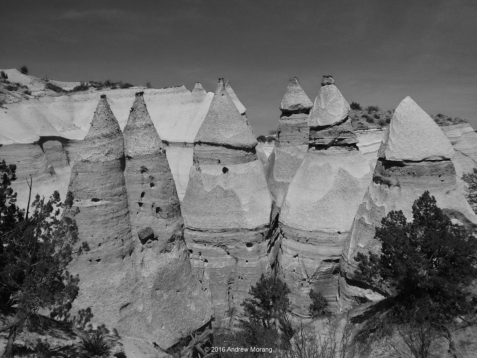
Kasha-Katuwe Tent Rocks National Monument, an terrain of rock pinnacles, cones, and narrow canyons. President Bill Clinton established the Monument in January, 2001. It is operated by the Bureau of Land Management (BLM), and if you have a National Parks pass, you can access the rocks without additional fee. According to
Wikipedia, "Kasha-Katuwe means "white cliffs" in the Pueblo language."
This rugged terrain of weathered spires and pinnacles was created by layers of volcanic rock and ash deposited by
pyroclastic flow ("a dense, destructive mass of very hot ash, lava fragments, and gases ejected explosively from a volcano and typically flowing downslope at great speed") from an explosion about 6 or 7 million years ago from the Jemez volcanic field. Since then,
weathering (chemical or mechanical deterioration of rock material) and
erosion (movement of rock material by water, wind, or ice) of these relatively soft layers has created the canyons and tent rocks. The tent rocks are cones of pumice or tuff upon which a cap of harder rock has remained, almost looking like some giant hand must have balanced it on the cone below.
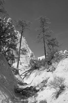 |
| The pines cling to the rocks with roots reaching down into cracks to find water. |
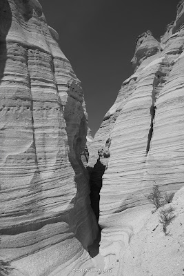 |
| Yes, the Slot Canyon trail goes through this slot. |
There are a number of hiking trails. They are not too rugged: you can do them with running shoes. But better not use flip-flops, as some tourists demonstrate (hint: there are rattlesnakes). Wear a wide-brimmed hat and take water. The Slot Canyon trail makes for a nice 3 or 4 hour outing.
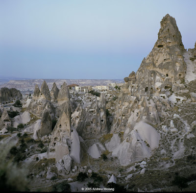 |
| Uchisar, Cappadocia, Turkey (Rolleiflex 3.5E film photograph) |
The only other place I know of with similar cones and spires of volcanic tuff and ash is in Cappadocia, in central Anatolia, Turkey. The Goreme area of Cappadocia was settled by early Christians, who carved homes, churches, and entire towns into the soft rock. First visit Kasha-Katuwe, then go to Cappadocia (but I will admit, I did it in the opposite order). Both are astonishing scenic and cultural wonders.
Dear Readers, this is the last of my 2016 Route 66 posts. Thank you for riding along.