Showing posts with label Deer Creek. Show all posts

Saturday, May 13, 2023

Tragedy in Rolling Fork, Mississippi

March 24, 2023, tornado path (from AccuWeather via Yahoo)

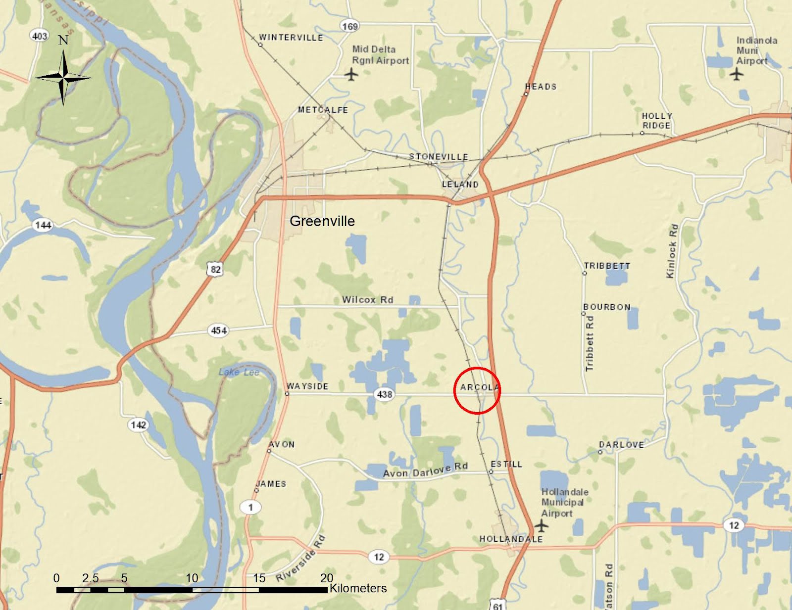
On Friday, March 24, 2023 around 8:00 pm, a tornado rated at EF-4 tore through west central Mississippi. It touched down just southwest of the small town of Rolling Fork before moving northeast toward Midnight and Silver City and then continuing toward Tchula, Black Hawk and Winona. 


Tornado path within Rolling Fork (from 25ABC)

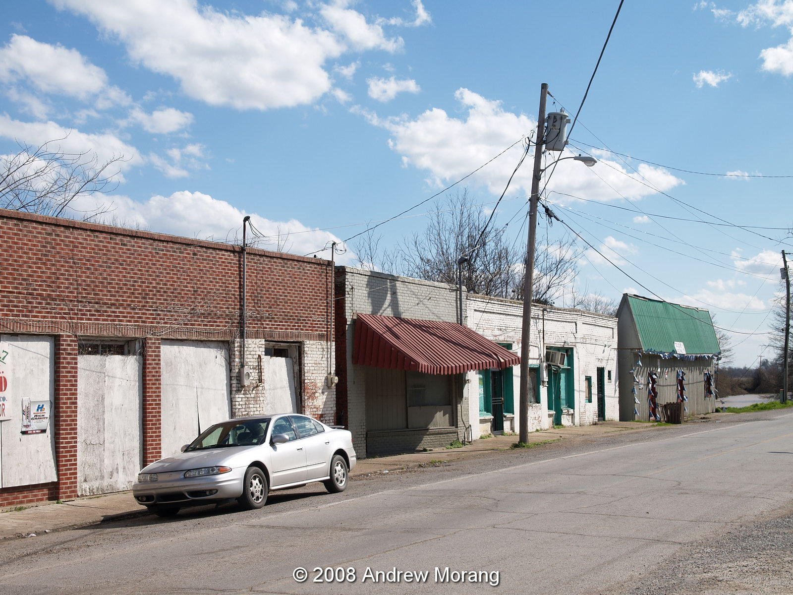
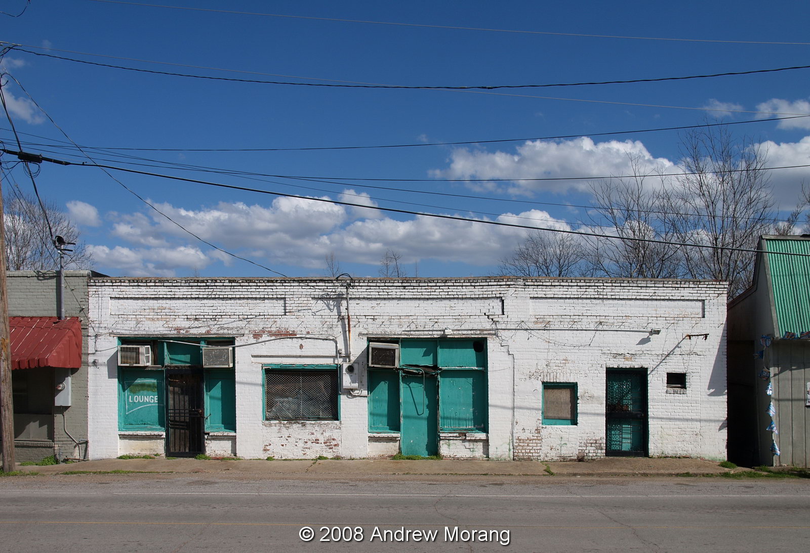
In Rolling Fork, the terrific winds flattened many blocks of the little town, flipped cars, knocked down the water tower, and shredding trees. The storm killed 26 people that night in Mississippi, with 16 in Rolling Fork. It is a town of fewer than 2,000 residents. Muddy Waters claimed it as his hometown.   

The town was a real mess. We could not drive on the side streets away from US 61, but that was enough to show the damage.


The truck's horn abruptly started beeping when we were next to it. Some power company employees climbed up to it and thumped the body. The horn stopped.

Power company crews repairing electric lines
Scott Petroleum at 19840 US-61 (Samsung phone photo)

Highway 61 had already been bulldozed clear by March 28. 

Have a seat, Hwy 61

The State Police were routing through traffic on Hwy 1 around Rolling Fork. But US 61 was open for repair trucks, supplies, and ambulances.

Snapped tree, Race Street
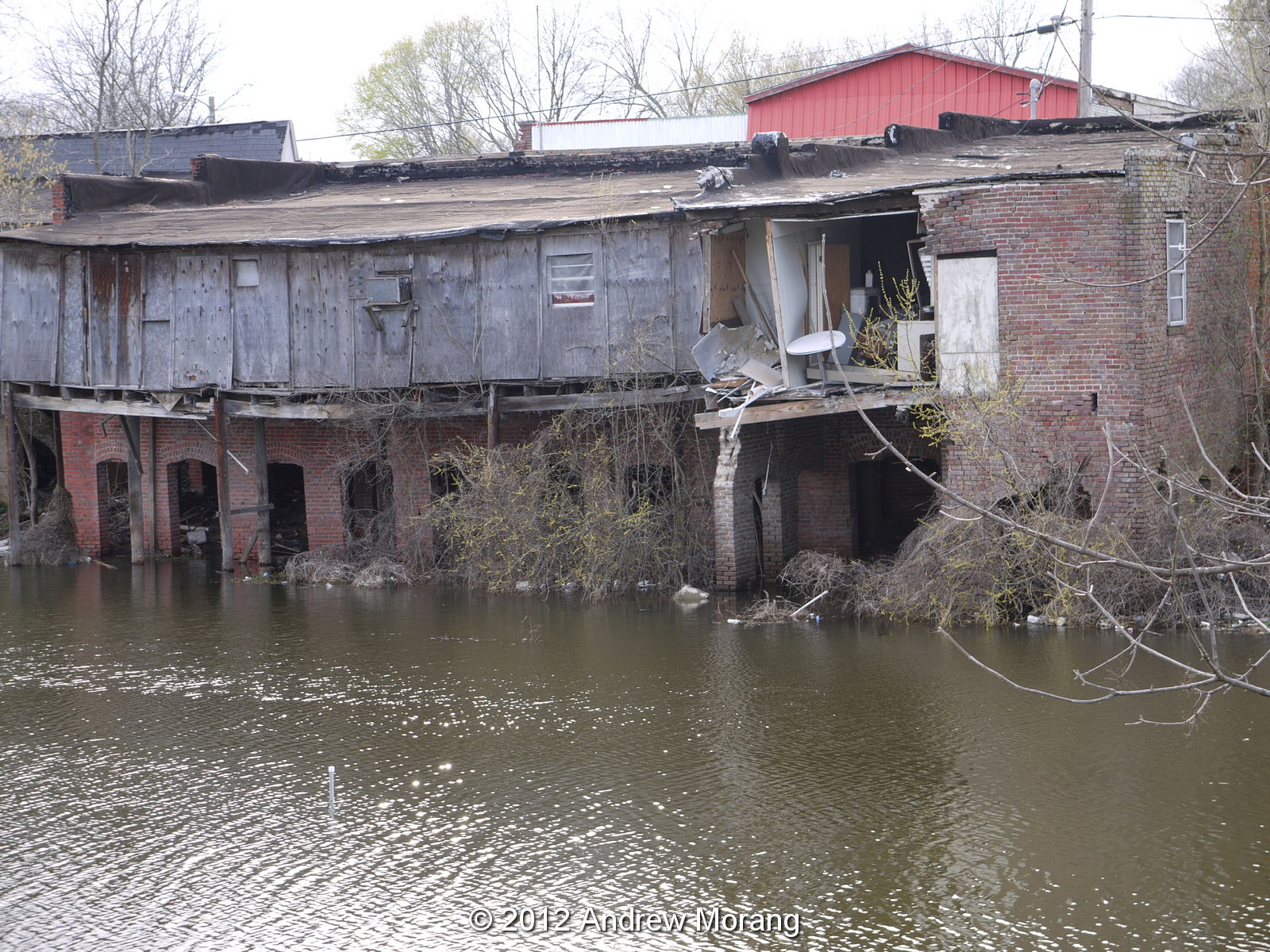
Note how the tree has been shattered but the nearby house was intact. Astonishing.

Deer Creek

Deer Creek starts in Bolivar Lake and winds its way south through the Mississippi Delta. I have taken pictures in Onward, Leland, and other small towns through which Deer Creek flows.


The water truck (Samsung phone photo)
Water donations at Sharkey-Issaquena Academy

The tornado tore through the Delta while my wife and I were in Houston. We drove home via Shreveport, Louisiana. We bought water in Shreveport to donate because we thought most bottled water supplies anywhere near the disaster zone would be gone. But as of Tuesday afternoon, March 28, there was plenty of water on pallets. Still, the volunteers were glad to have our packages. 

The tornado knocked down Rolling Fork's water tower. I do not know the status of a repair. 

For more photographs of tornado damage, Reuters posted an excellent collection taken from drones and by news reporters on the scene.

I hope the residents can rebuild and put their lives back together. 

The little town of Silver City was also devastated. I have not been there for post-storm pictures. But I have photographed there in 2020 and 2022 (click the links). 

I took these photographs on Kodak Portra 160 film with a Pentax Spotmatic camera and the 35mm ƒ/3.5 Super-Takumar lens. Dwayne's Photo developed the film and I scanned it with my Plustek 7600i film scanner. 

Tuesday, April 10, 2018

The Mississippi Delta 26: New Hope MB Church, Estill

In October of 2017, the Mississippi Heritage trust announced its 2017 list of 10 Most Endangered Properties. On the list was a handsome wood church in the hamlet of Estill, north of Hollandale. I had never heard of the site before, so my wife and I checked it on our early April Delta trip. The church is on Walcott Road just north of the intersection with Avon-Darlove Road.

From the Heritage Trust:
New Hope Missionary Baptist Church-Estill
Nominated by Kendall Aldridge

New Hope Missionary Baptist Church is a rare example of an early twentieth century rural African American Delta church. Constructed in 1918, the building survived the great flood of 1927 because of its close proximity to Deer Creek, which is higher than the surrounding land.  A wood-framed building with hints of Gothic Revival style in the infilled pointed arches, the abandoned church has several large holes in the roof, allowing rain to poor in.  In addition to the leaking roof, there are cracks between much of the clapboard siding, allowing water to blow in during a storm.
 You can see the pride that the original founders took in their church from the engraved corner stones.
The church was closed, but I could take one interior picture by holding my phone against a glass pane. While walking around, a gent in a truck and a lady in a car stopped and asked if I was going to restore the church. I assume they were aware of the listing on the most endangered list, but I had to disappoint them that I had no connection with any restoration efforts. The lady said she lived on the adjoining farm. She said there were many pictures of river immersion baptisms from decades ago. I checked on the Library of Congress holdings but did not find any such pictures.

These snapshots are from a Motorola Moto G5 mobile phone. I also took some real photographs on Kodak TMax 100 film with a Spotmatic, but these need to be developed and scanned. Please wait for an update.

Update: July 2018. Preservation Mississippi announced that the The Delta National Heritage Area announced its 2018 grant awards. One of these was to support stabilization of the church in Estill:

• Mississippi Heritage TrustJackson, MS – $24,500 to support preservation of the New Hope Missionary Baptist Church building in Estill, Washington County, MS, by installing a metal roof, securely storing church pews and furnishings, and engaging the congregation and other residents in developing a long-term plan for use of the building

Sunday, March 18, 2012

The Mississippi Delta 5: Arcola


This is the fifth post on the Mississippi Delta. This is not the delta of the Mississippi River that protrudes south into the Gulf of Mexico. Rather, when most people refer to "the Delta," they are thinking of the rich alluvial plain that lies between the Mississippi and Yazoo Rivers, with Vicksburg marking its southern limit and Memphis the northern. The map above, from the US Geological Survey (downloaded from Wikipedia), shows the area. The delta has a unique cultural, racial, and economic history. Before the American Civil War, it was one of the richest cotton growing areas in the world and attracted wealthy planters, who imported black slaves to work the plantations.

According to an article in the Vicksburg Post on March 18, 2012, by Terry Rector (Warren County Soil and Water Conservation District), the Mississippi delta soils are among the most productive for agricultural crops in the country. Alluvium is the name given to river-deposited soils, which consist of minerals and materials derived from the hinterlands that form the river's drainage basin. Two common soil types found in the Delta are the Memphis Silt Loam and the Commerce Very Fine Sandy Loam. These were among the easiest for farmers to work and were the first to be converted from forest to cropland two centuries ago. When farmers referred to good Deer Creek soil, they were referring to the sandy loam soils along much of Deer Creek.

Times have changed and the Delta is now economically in very rough condition. In the late-1920s (following the great 1927 Mississippi River flood) thousands of farm workers left for the North to escape brutality, abject poverty, and racism and seek factory jobs in cities like Chicago and Detroit. Also, mechanization of agriculture, especially mechanical cotton harvesting, eliminated the jobs of thousands of farm workers. According to Wikipedia, "From the late 1930s through the 1950s, the Delta experienced an agriculture boom, as wartime needs followed by reconstruction in Europe expanded the demand for the Delta region’s farm products. As the mechanization of agriculture continued, women continued to leave the fields and go into service work, while the men drove tractors and worked on the farms. From the 1960s through the 1990s, thousands of small farms and dwellings in the Delta region were absorbed by large corporate-owned agribusinesses, and the smallest Delta communities have stagnated." As late as the 1960s, many towns like Rolling Fork, Leland, and Greenville were still active, bustling communities. But now many of these towns are semi-deserted, with empty business strips, collapsing shops, and grim poverty.

The photographs below are from Arcola, a town on Deer Creek north of Hollandale and south of Leland. The railroad once came through here, but the tracks were removed in the 1980s.
Deer Creek Drive is the main strip. All that is left is a gas station/convenience store and several lounges (or dives). Even on a sunny day the strip is depressing.
Here is another lounge. It says a lot that a small town has two drinking spots.
Here is a deserted super market on Martin Luther King Drive.

An architectural oddity: many of the shops on Deer Creek Drive were built out over the banks of the creek on brick pillars, As you can see, the floors have collapsed.
Farm houses once dotted the countryside. But now, many, like this example at 1862 Hwy 438, are deserted.

All photographs taken with Olympus E-330 and Panasonic G1 digital cameras.